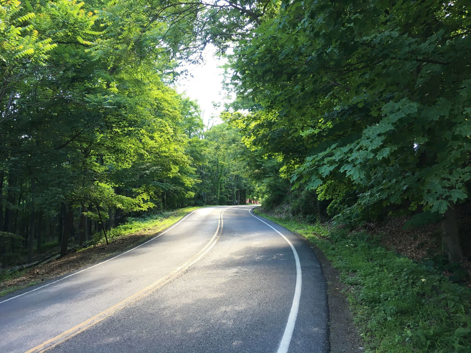
My most memorable climb was in Harlech, Wales. I had developed a habit of pedaling up all the hills, resting when I needed but never walking. I remember on this hill, I had to stop and stand every few yards because it was so damned steep. Well, now I find out that Harlech has the steepest road in the world. I don't know if I took this exact route, but I did climb one of that town's steep roads.
Tuesday, March 5, 2019
Memorable climbs
In 1981, I was 20 years old, and I gave my life (college, job, apartment) to travel. My father encouraged me, and he said that I wouldn't be likely ever again to have the unbounded time and the money to travel. Being 20 years old, I couldn't believe or grasp this, but I took his advice, which was to go until my money ran out. So of course, it was a memorable experience, traveling for three months wherever the rains led me. And I had a lot of rain.
My most memorable climb was in Harlech, Wales. I had developed a habit of pedaling up all the hills, resting when I needed but never walking. I remember on this hill, I had to stop and stand every few yards because it was so damned steep. Well, now I find out that Harlech has the steepest road in the world. I don't know if I took this exact route, but I did climb one of that town's steep roads.
My most memorable climb was in Harlech, Wales. I had developed a habit of pedaling up all the hills, resting when I needed but never walking. I remember on this hill, I had to stop and stand every few yards because it was so damned steep. Well, now I find out that Harlech has the steepest road in the world. I don't know if I took this exact route, but I did climb one of that town's steep roads.
Thursday, July 19, 2018
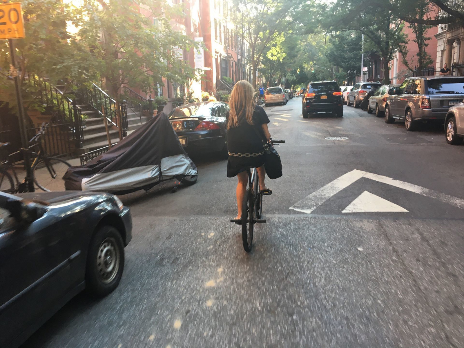
It takes all kinds
On my way home, I saw another bike commuter who had a whole lot of incongruous elements. She was riding a BMX bike with pegs on the rear axle. Already that's fairly unusual. She had a speaker on her handlebar blaring rap music, complete with lots of curse words. She had a heavy chain around her hips. She was well dressed and had a fancy bag over her right shoulder and an expensive haircut and color job. She had a cigarette in her left hand. At first she passed me by running a red light in a way I wouldn't risk my life, but hey, she's used to it. I pulled just slightly ahead of her at the next light which we both had to wait at. I saw from her face that she was at least 45 years old and possibly over 50. Why is a well dressed woman riding a BMX bike aggressively through traffic blaring rap music? Well, in New York City, it truly takes all kinds, for sure.
Saturday, November 4, 2017
Barriers on the Hudson River Greenway
The newly placed barriers on the Hudson River Greenway are grossly misguided and are causing problems. They will cause more problems, and they solve no problem whatsoever. It was a problem that a terrorist killed and injured so many people. Believe me, I am shaken, as I ride that path every day. But this response is not a solution. Doing nothing would have been better than this response. Some may be comforted that the city did something. It may give some the illusion of increased safety. That illusion serves no one. Doing something, anything, as long as it’s something, is not rational or humane or even intelligent. The barriers create pinch points which will cause bike-bike and bike-pedestrian collisions. I’m sure it will, and if they stay for much longer, you will see this, I promise. And they will not prevent any terrorist attacks. Those attacks rely on opportunity and surprise. The next attack will be of a completely different nature in a different kind of place precisely because surprise is a key ingredient. Therefore, creating this kind of widespread inconvenience serves no one and disserves many of us. Let’s use resources in that will combat the risk that are in proportion to the risk. That risk is very small even though the attack was so horrific. We accept that we might die of heart disease or in a car collision, but we do not want to die with many others all at once through a vile deliberate act. Yet the disgust over such a kind of death does not justify any and all costs or precautions. We need to move as freely and as quickly and as enjoyably as is reasonable. The barriers are a disproportionate and unreasonable measure.

Monday, June 20, 2016
Traveling to and from a conference in Poughkeepsie
I signed up for a conference called the NYSERNet Tech Summit which was held this year at Vassar College in Poughkeepsie on June 16 and 17. NYSERNet is a consortium of technology professionals working in higher education (and other non-profits such as museums) in New York State. We have a weekend house in High Falls, NY (town of Marbletown, NY) and it's a reasonable distance to cycle, so I decided to travel to the conference on bike.
The route I took to the conference was mostly on rail trails. A rail trail is a right-of-way formerly used by a rail line, renovated to be a walking and cycling route. Since rail trains can't handle steep grades, rail trails are almost always without hills of any significant slope. This makes it peaceful and reduces the challenge but can also be boring if you like climbing and descending hills. Rail trails are generally quiet and free of motor vehicle traffic, so they are like havens. There is plenty of wildlife, flora and fauna, to observe and enjoy.
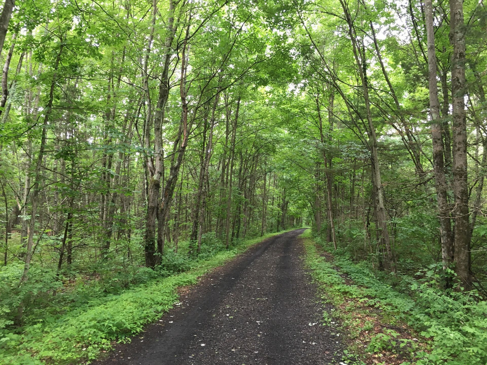
An entrance to the Wallkill Valley Rail Trail is near the house. It's sometimes called a vernal tunnel.
The surface on this trail is soft, with very small rocks. It's not hard to stay upright on this surface, even if you're not a very skilled cyclist.
I needed to be at the conference at 11am on Thursday. Leaving a little extra time at 8:20, the weather was cool and rainy, which I hadn't planned on when I packed my clothes. I found clothes to compensate: I put a lightweight wool shirt over my cycling jersey and a flannel shirt over that. I wore a cotton cycling hat under my helmet. My wife offered to drive me halfway, and I considered the fact that if the rain got heavy and I didn't accept her offer, I might regret it after getting cold and soaked. But the rain didn't last long, and I took off all of those extra layers leaving me wearing just cycling shorts and a cycling jersey. It was a perfect combo.
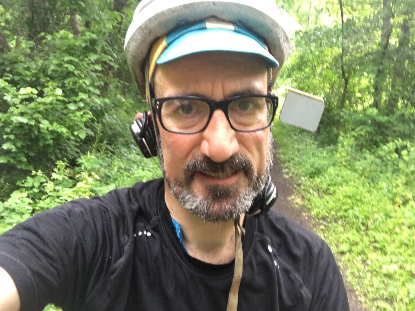
Here is an obligatory selfie with the cap and helmet, before I removed my extra layers.
I got off the Wallkill Valley Rail Trail in New Paltz and rode over public roads through Lloyd and to Highland where I entered the beginning of the Hudson Valley Rail Trail. This trail is paved with asphalt.


The route I took to the conference was mostly on rail trails. A rail trail is a right-of-way formerly used by a rail line, renovated to be a walking and cycling route. Since rail trains can't handle steep grades, rail trails are almost always without hills of any significant slope. This makes it peaceful and reduces the challenge but can also be boring if you like climbing and descending hills. Rail trails are generally quiet and free of motor vehicle traffic, so they are like havens. There is plenty of wildlife, flora and fauna, to observe and enjoy.
An entrance to the Wallkill Valley Rail Trail is near the house. It's sometimes called a vernal tunnel.
The surface on this trail is soft, with very small rocks. It's not hard to stay upright on this surface, even if you're not a very skilled cyclist.
I needed to be at the conference at 11am on Thursday. Leaving a little extra time at 8:20, the weather was cool and rainy, which I hadn't planned on when I packed my clothes. I found clothes to compensate: I put a lightweight wool shirt over my cycling jersey and a flannel shirt over that. I wore a cotton cycling hat under my helmet. My wife offered to drive me halfway, and I considered the fact that if the rain got heavy and I didn't accept her offer, I might regret it after getting cold and soaked. But the rain didn't last long, and I took off all of those extra layers leaving me wearing just cycling shorts and a cycling jersey. It was a perfect combo.
Here is an obligatory selfie with the cap and helmet, before I removed my extra layers.
Why do selfies suck most of the time?
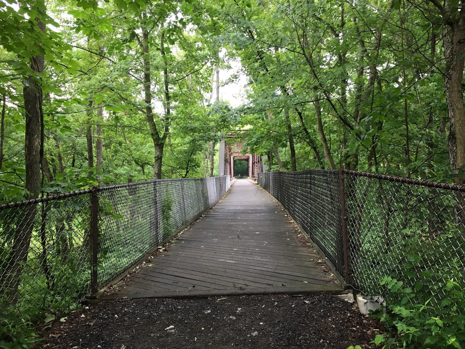
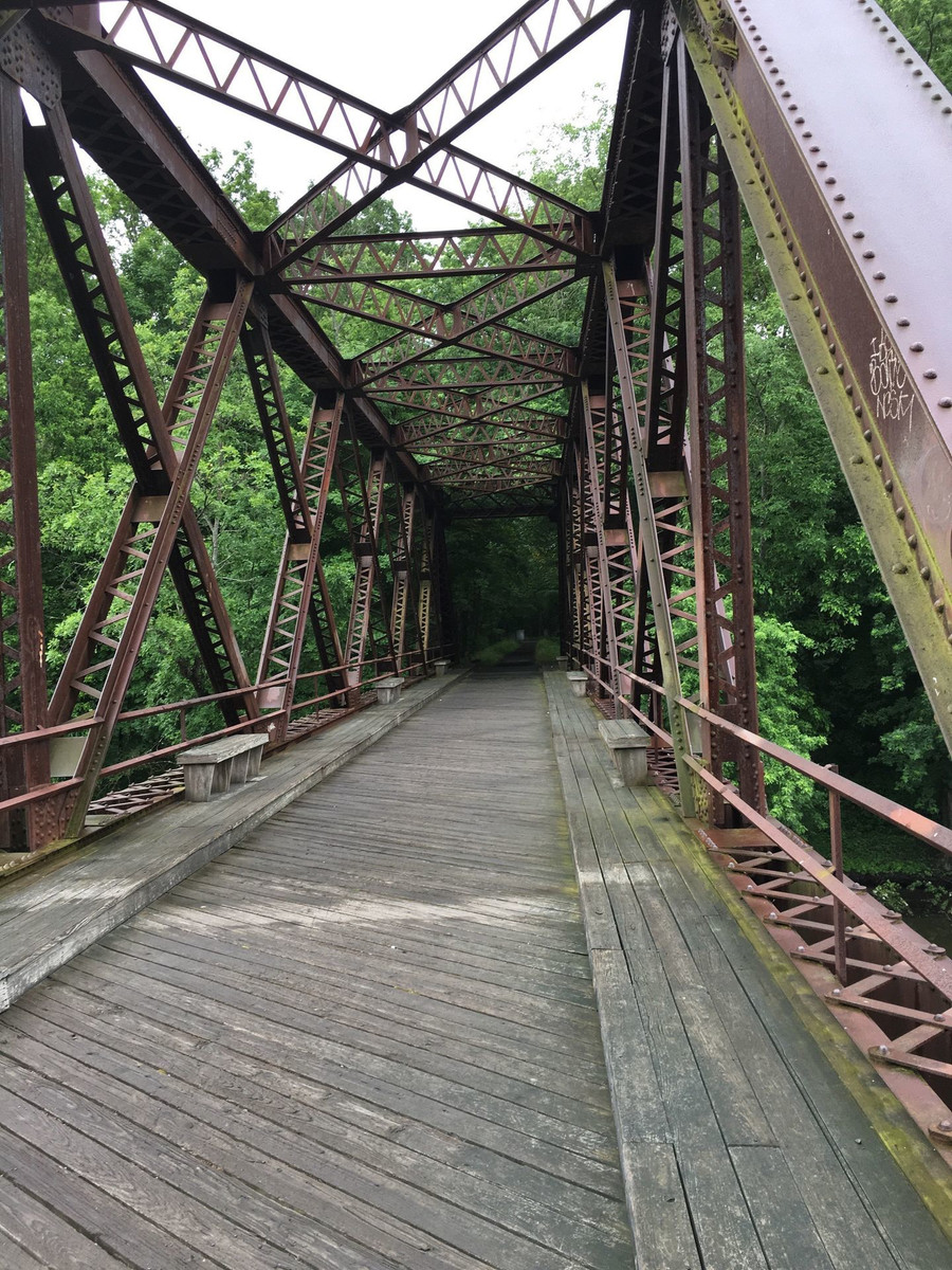
This is the bridge that crosses the Wallkill River
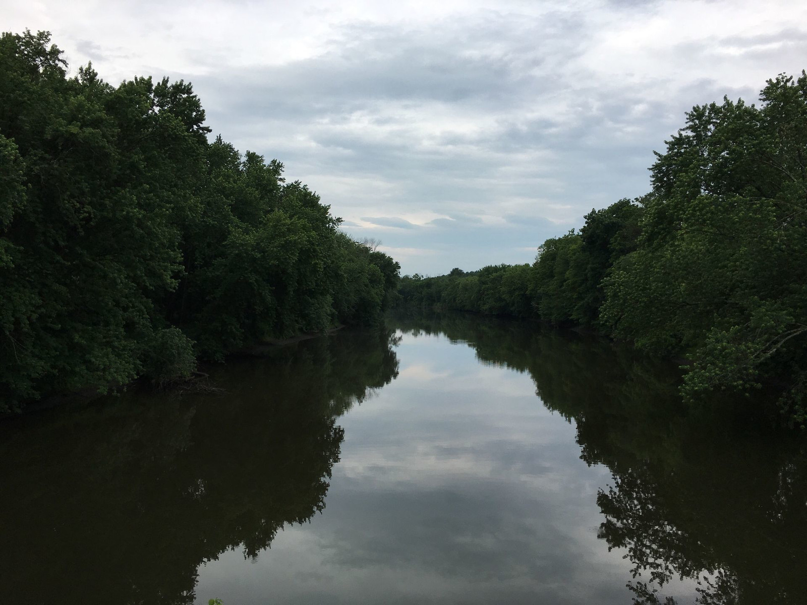
and here is a scene I shot from the bridge.
There are remnants of the former stations along the trail.
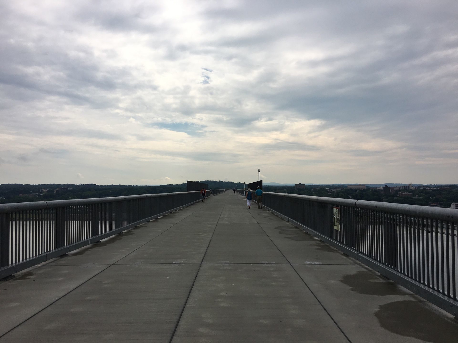
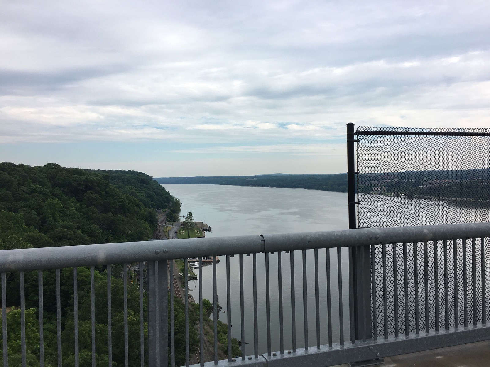
The trail includes the Walkway Over the Hudson, which is the world's longest pedestrian bridge. The Hudson River is about a mile wide.
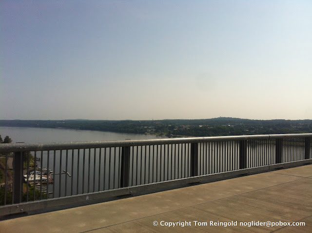
The bridge you see from this bridge is the Mid-Hudson Bridge, which allows motor vehicle traffic.
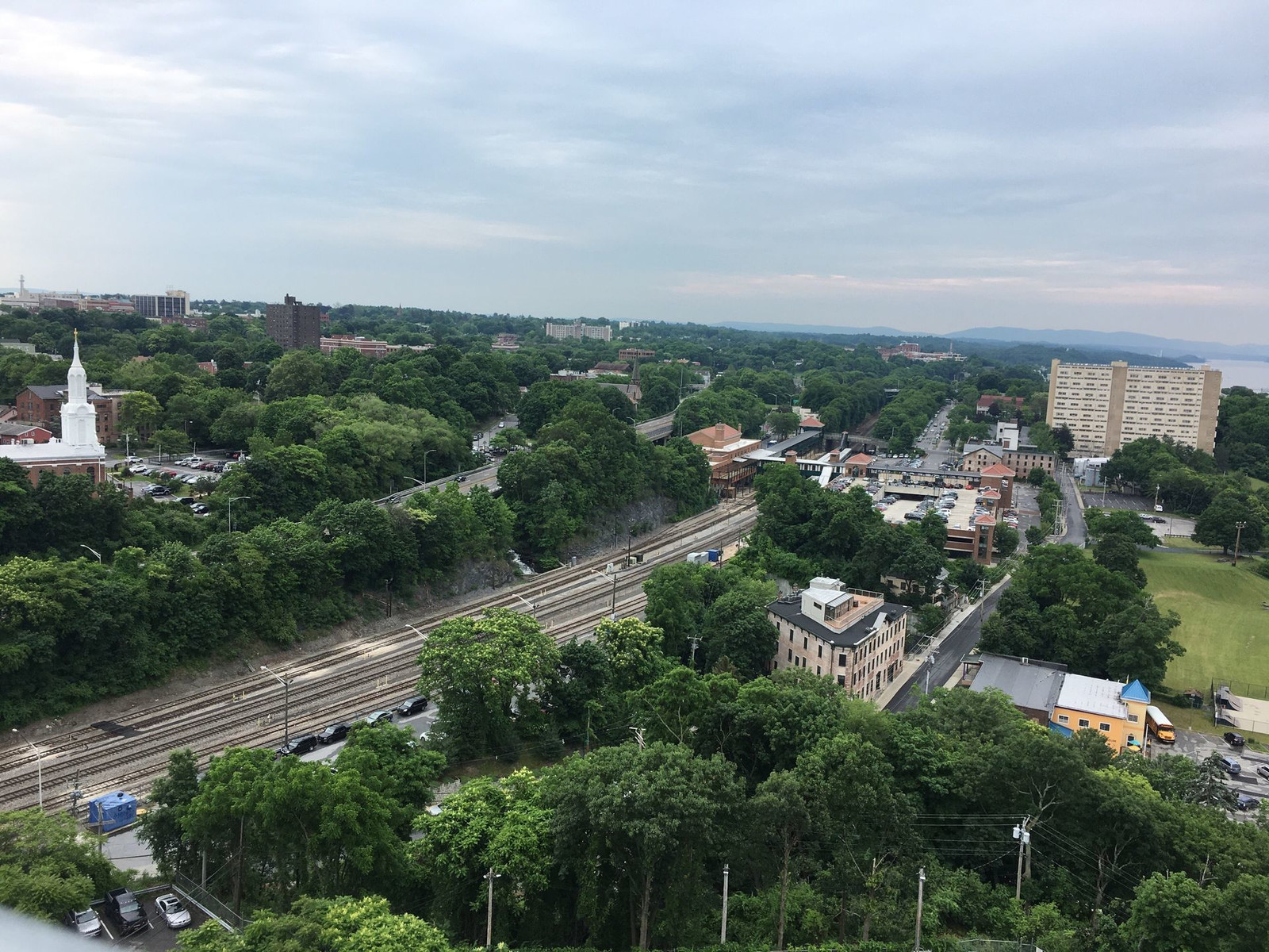
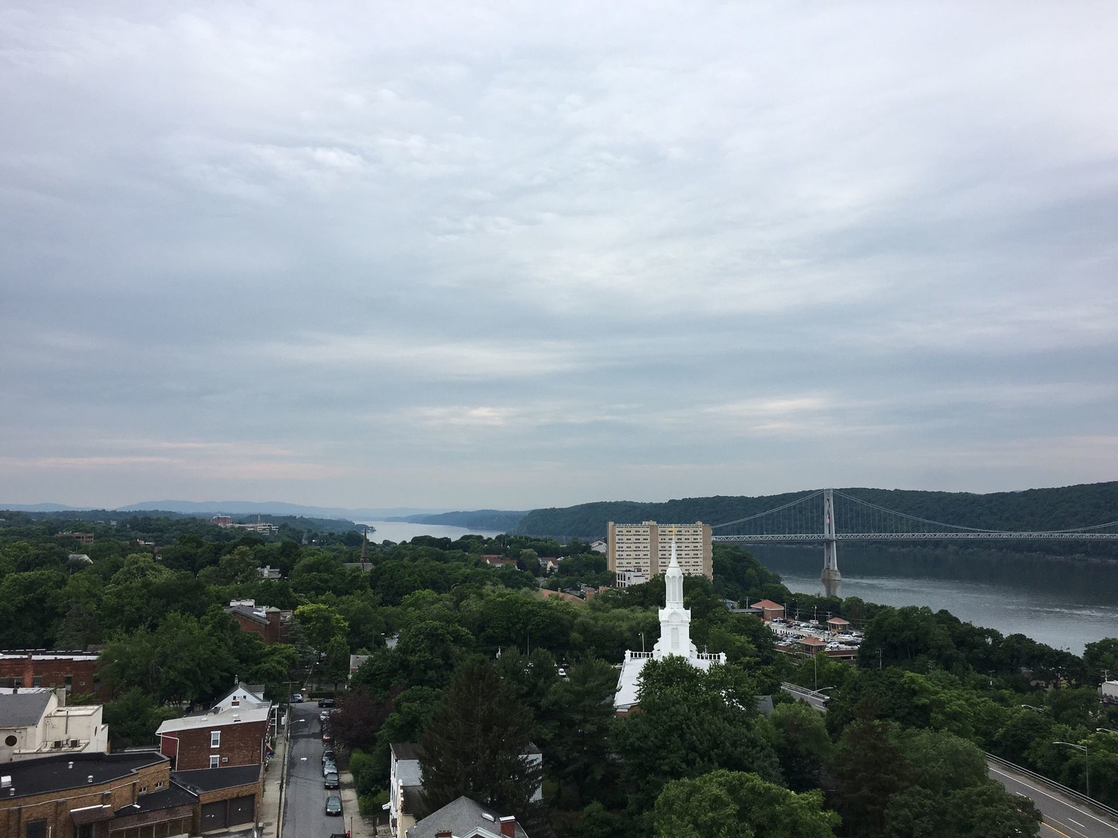
This is Poughkeepsie as seen from the bridge.
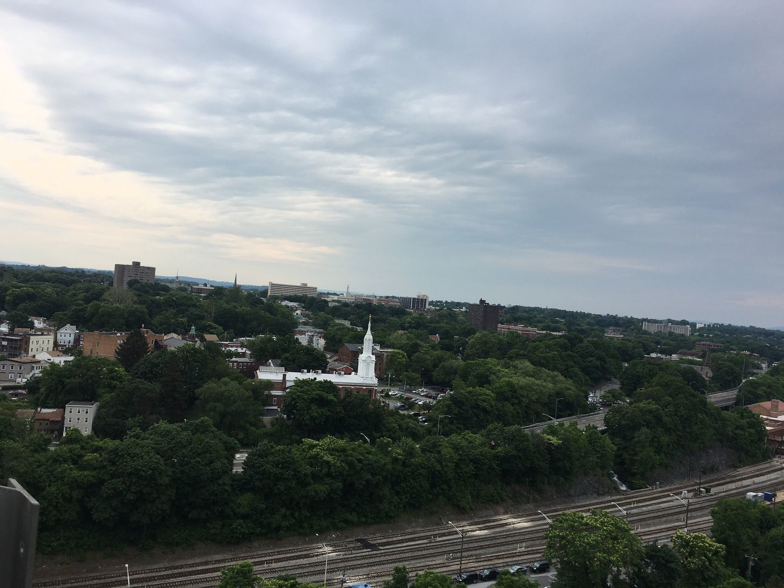
Here is Poughkeepsie as seen from the surface of one of its streets. It seems that nearly every house in Poughkeepsie has at least one porch.
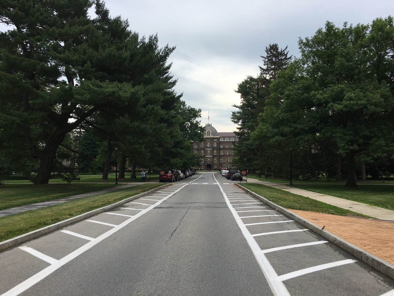
Here is the grand entrance to the Vassar College campus, a spectacularly beautiful place.
Since I hardly did any climbing and I was not in any rush, I arrived quite fresh. It was a 24 mile ride, and you can see an excess of charts and graphs at this link. There is a graph of elevation over distance, where you can see my maximum altitude was about 400 feet. The graph has an error, showing me to be traveling on the river's surface whereas the bridge is actually more than 200 feet up. If you're curious to know how fast I went and all that stuff, click the "Metrics" tab on the right.
The last event of the conference on Thursday was a chance to eat and drink and meet people at the hotel, so I rode 2.8 miles across town to the Poughkeepsie Grand Hotel. Here is that ride's link, and this is my bike, without my luggage, locked to a lame bike rack at Vassar College. I guess bike theft isn't a serious concern at Vassar.
Friday morning, I went back across town to Vassar for the second half of the conference, which included a tour of the college's newest building called the Bridge for Laboratory Sciences. It is called that because the building is placed over a marshy area which would not be able to support a building. The solution was to start with two towers and make the building in the same way suspension bridges are built.
Returning to the house, I decided to try something different. Rather than going around the mountain (the Shawangunk Ridge), I wanted to try going over the top of the mountain. I had ridden up the mountain three times before, always from west to east. This would be my first time doing it east to west and also my first time using a bike heavily laden with luggage which weighed an extra 35 pounds. I'm a pretty good hill climber, and I might not have stopped along the way except I had two small equipment problems (with my derailleurs) and also photo opportunities. The east-west climb is hard because it doesn't have any plateaus; it just keeps climbing, and the grade is often around 9%. That's steep!
If I'm reading the charts right, it took me about 50 minutes to travel the three miles up the mountain, which is about 1,100 feet tall. I'm happy to report that while the roads are narrow and winding, I was not injured by a motor vehicle or by falling during my low speed ascent or my high speed descent. I wasn't exhausted, either.
This is the Walkway Over the Hudson as seen from beneath it, on the Poughkeepsie side.
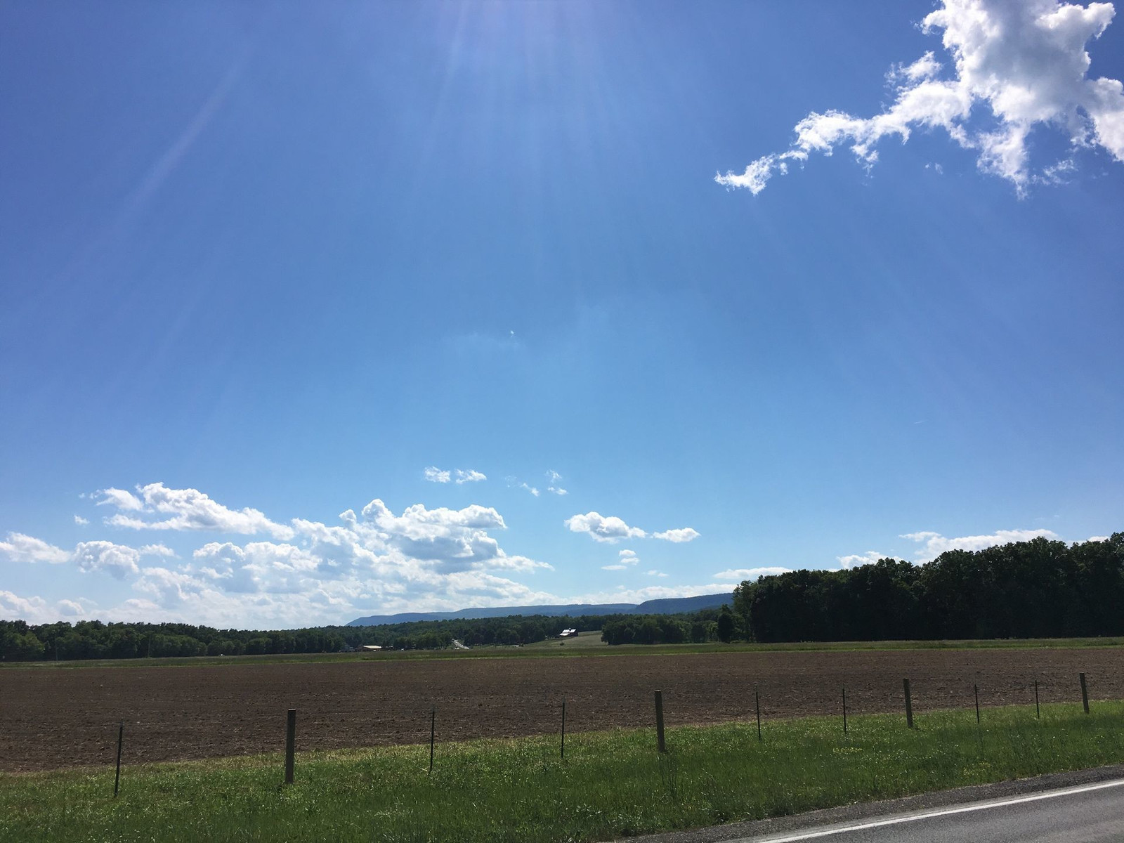
In New Paltz, this is a view of the plain in the foreground and the ridge in the background. I don't think I captured how large it looms. It's very steep.
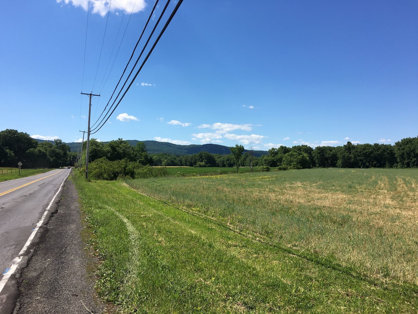
Here is the middle of the climb, and this shot doesn't capture the steepness of the road.
The route I took back was 21 miles, i.e. 3 miles shorter than the route out, and to my surprise, the return trip was three minutes shorter. I thought all that slow climbing would add time to the trip, but I guess the miles I saved made the difference. The trip back was definitely more physically challenging. My average speed over the course, 10.5 mph, was slower than the average going out, 11.7 mph, not surprisingly. I didn't rush on either ride.
Friday, April 22, 2016
Bike commuting update, April 2016
I often say I ride to work and back two days a week and take the subway three days a week, but I probably really average riding fewer than two days a week. I hope to increase the average, maybe to three, maybe more.
Today, I reached my short term goal, though I've done four rides between work and home over the course of three days. Monday, I rode home on the bike I had left at work last week, my Bianchi Volpe. Wednesday, I rode to work on my Viscount fixed gear bike and rode home on my Raleigh Super Course which had been sitting in my office for months. I left the Viscount at the office because I like to keep a spare bike there. So on four rides, I rode four separate bikes.
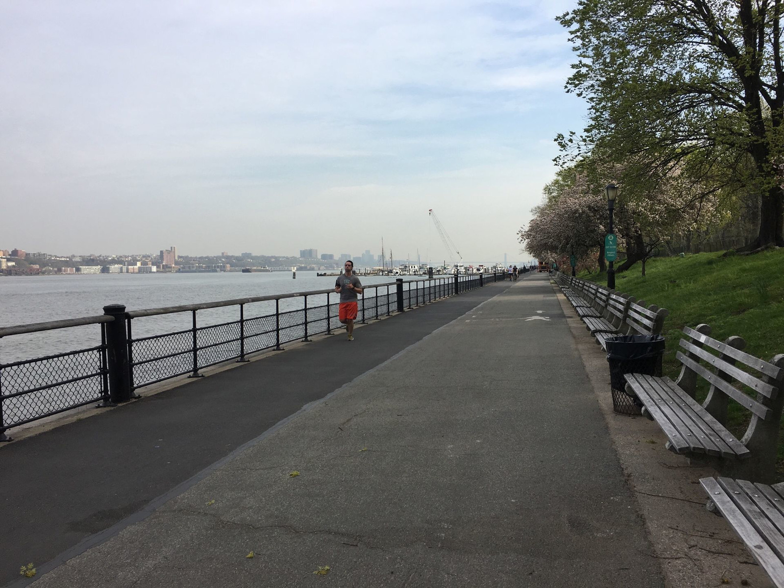
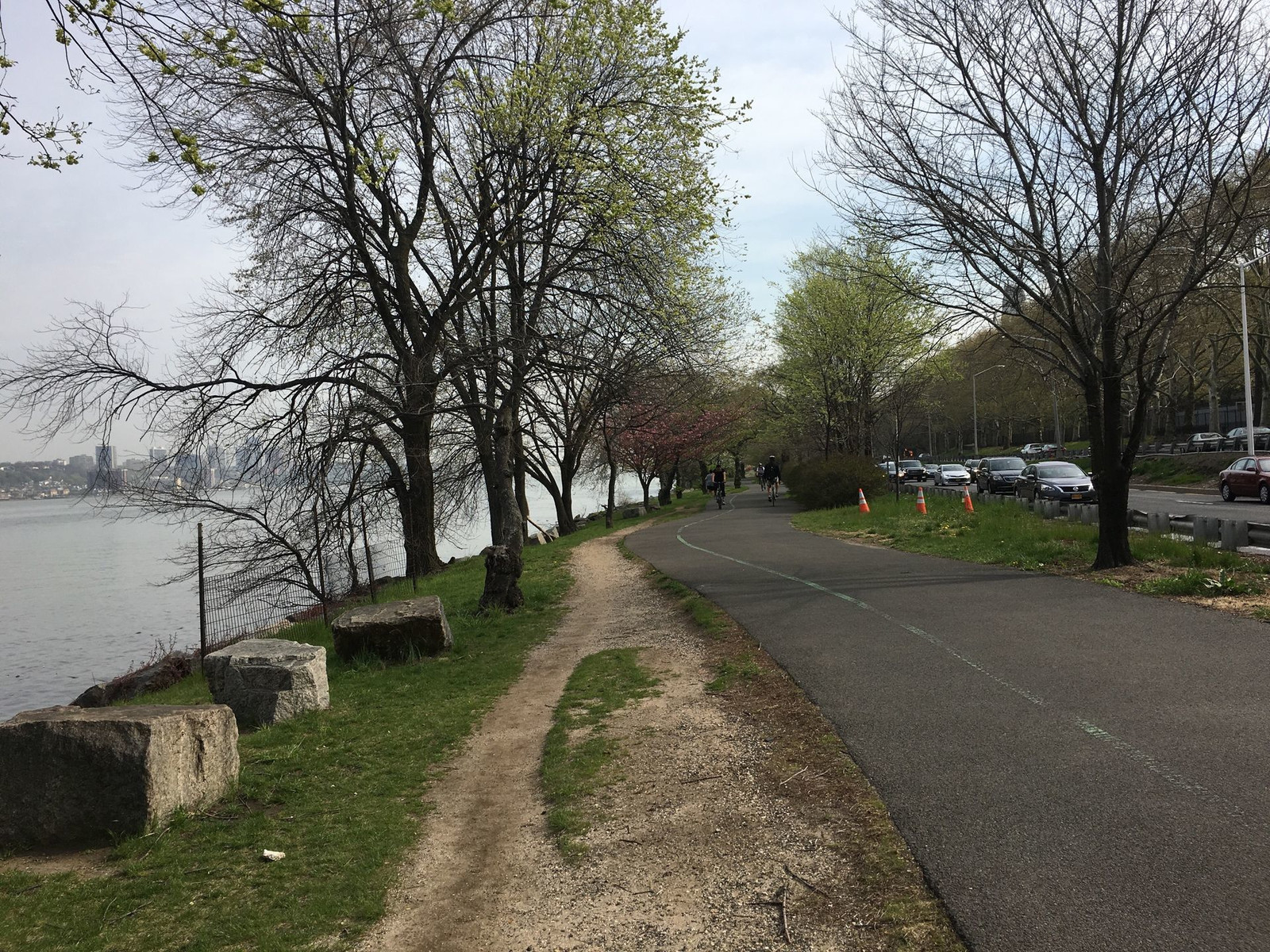
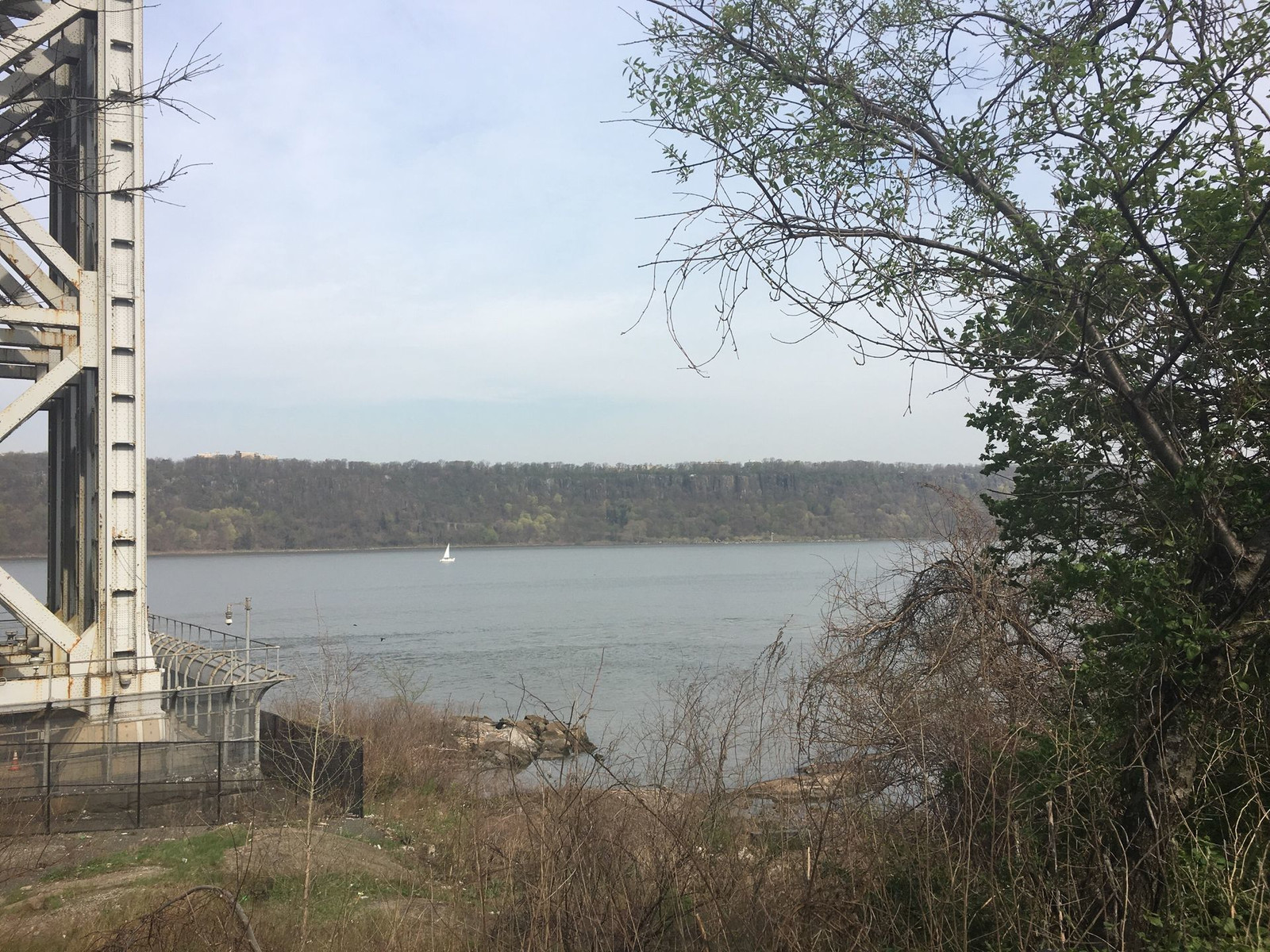
This morning (Friday), I rode my Lemond, which I hadn't ridden in months. I've been thinking I ought to sell this bike because I don't ride it often and it's a bit too small for me. This morning's ride changed that thinking. I had a lot of fun and not a whole lot of discomfort. I like to think that the weight of a bike isn't a big factor in the speed at which you travel, but this bike proves that to be wrong. Besides being more energy efficient, some bikes position me in such a way that encourages me to pedal harder. I made it to work in record time, less than an hour. The distance was 13.8 miles, and my average speed was 15.6, which is much higher than normal for me. It helped that there is virtually no wind today. I normally face a stiff headwind in the morning. The wind was so light that I thought I had a tail wind, but actually, there really isn't any wind, which is pretty unusual for the Hudson River.
If you want to see the path I took and an excess of statistics my smartphone app took, see them here.
Anyway, I had a blast. Here are pictures I shot along the way. You can click on them for the full size images.
Today, I reached my short term goal, though I've done four rides between work and home over the course of three days. Monday, I rode home on the bike I had left at work last week, my Bianchi Volpe. Wednesday, I rode to work on my Viscount fixed gear bike and rode home on my Raleigh Super Course which had been sitting in my office for months. I left the Viscount at the office because I like to keep a spare bike there. So on four rides, I rode four separate bikes.
This morning (Friday), I rode my Lemond, which I hadn't ridden in months. I've been thinking I ought to sell this bike because I don't ride it often and it's a bit too small for me. This morning's ride changed that thinking. I had a lot of fun and not a whole lot of discomfort. I like to think that the weight of a bike isn't a big factor in the speed at which you travel, but this bike proves that to be wrong. Besides being more energy efficient, some bikes position me in such a way that encourages me to pedal harder. I made it to work in record time, less than an hour. The distance was 13.8 miles, and my average speed was 15.6, which is much higher than normal for me. It helped that there is virtually no wind today. I normally face a stiff headwind in the morning. The wind was so light that I thought I had a tail wind, but actually, there really isn't any wind, which is pretty unusual for the Hudson River.
If you want to see the path I took and an excess of statistics my smartphone app took, see them here.
Anyway, I had a blast. Here are pictures I shot along the way. You can click on them for the full size images.
Tuesday, July 14, 2015
Century ride, 2015-07-12
Carol and I had a graduation party to attend in Yonkers on Sunday evening. Carol had some errands to run in the day, so I thought I would make a long ride out of it. We were at our place in High Falls, NY (near New Paltz), and Google Maps told me it would be an 89-mile ride.
We don't have a printer at the house, so I hand-copied the directions from the computer onto notebook paper. I clipped the directions to my handlebar bag. I also packed a lot of food plus a big external battery for my phone. I figured if I lost my way, I could use the phone to navigate, but I'd need extra charging capacity.
I left a little after 8am. I did get lost a few times, and I used the Google Maps app for a few periods, but I turned it off each time I got back on my course. At one point, I left the course deliberately because a bike trail was paralleling the road, and I used Google Maps to get me back on later. That worked out just fine.
I wore a little bicycle-specific GPS gadget on my wrist. It tracks where I go, how fast, etc. It was useful to count off the distances between turns.
With my several times of getting lost and one time of leaving the route on purpose, my total distance was 96 miles.
Much of the route was on bike trails, which are pretty nice to ride on. Sometimes the surface is rough, which slows me down a little, but the benefits are worth it. There is no motor vehicle traffic to cause stress, and it's much quieter. I have to watch for pedestrians and ride slowly around them, but that's a small price to pay. Most of the trails are old railroad lines with the tracks removed. Some are paved, and some are not.
The cable for my rear derailleur failed at about Mile 35. My front derailleur continued to work, leaving me with a choice of three different gears. I jury-rigged my rear derailleur to stay in a middle gear. In retrospect, I should have chosen a lower gear. The lowest of the three gears I had was still quite high. This made climbing hills very challenging. The biggest hill was Hosner Mountain Rd in Dutchess County, just south of Rt I-84. I challenged myself not to stop on any climbs until I reached the tops. Now that I look at my elevation profile, I can hardly believe I climbed that hill without a low gear.
My back and shoulders are weak and inflexible. I've been meaning to strengthen them for a long time. This makes riding for hours painful. Worse than that, I have a pinched nerve in my back which causes some pretty severe pain in my feet. Each hour gets worse. I think I don't want to take another very long ride until I can alleviate these problems. The second half of the ride was pretty painful.
But the weather was good, and the scenery was inspiring. I don't regret doing it at all.
Here is the log that my GPS unit created. You can zoom in and out on the map. You can also see graphs that show my speed over time and my elevation over time. You can see where I climbed about 250 feet in just about one mile, at Mile 41.
Here are pictures I took along the way. GPS information is embedded in them, so if you want to see the points where I shot the pictures, look at the page for this album.
Click on the images to see them bigger.
Rondout Creek

Rondout Creek

Walkill Valley Rail Trail

Walkill Valley Rail Trail

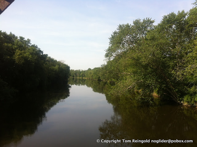
Walkill River (a redundant name)
Rt 299 going from New Paltz to Lloyd, one of the few non-gorgeo

Ah, that's better. Town of Lloyd.

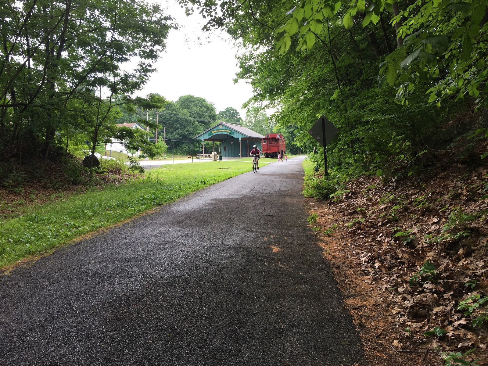
About to enter Hudson Valley Rail Trail in Lloyd

Hudson Valley Rail Trail. Notice the glacial rock on the right side. It's 20 or 30 feet tall.

An old station reused somehow, but I didn't investigat

Highland Station, now closed, of course, since the rail line is gone.

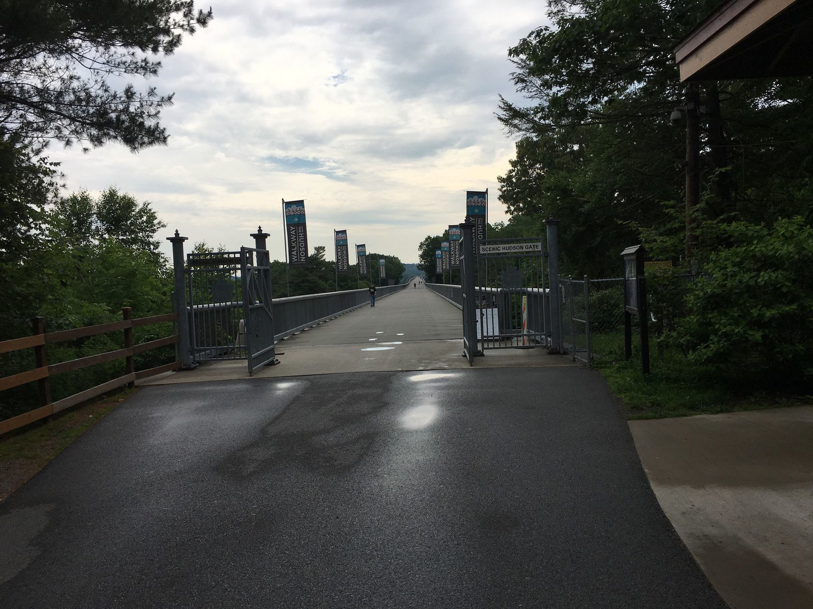
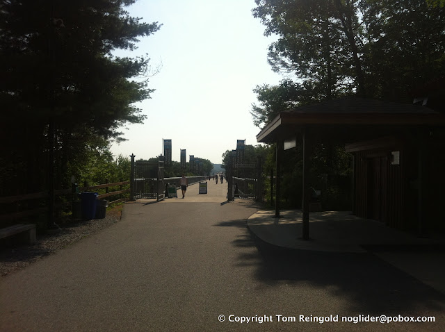
About to cross the Walkway Over the Hudson, opened to pedestrian
Walkway Over the Hudson

Hudson River as viewed from Walkway Over the Hudson. That bridge you see is the Mid-Hudson Bridge. Both of these bridges span the Hudson between Highland and Poughkeepsie.

Hudson River as viewed from Walkway Over the Hudson.
Hudson River as viewed from Walkway Over the Hudson.

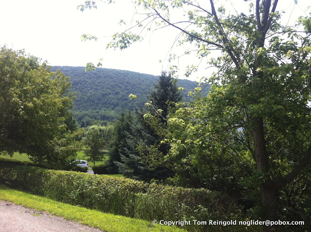
Hosner Mountain, whose switchback road doesn't switch back enough. The climb was very difficult, especially with a failed derailleur and resulting lack of low gears.
Hosner Mountain.
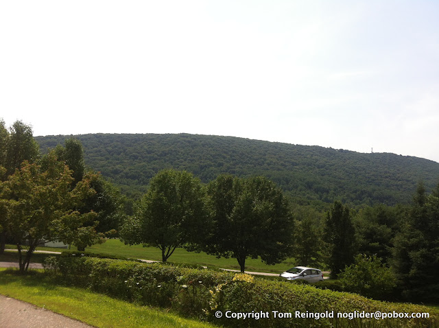
Hosner Mountain.

Now I can catch my breath a bit.

Crossing the West Branch Reservoir.

West Branch Reservoir.

Lake Gleneida in Carmel, NY.

An accidental selfie. Now you've seen my left knee.

Yorktown Heights, I think.

Hudson River, viewed from Yonkers.

Hudson River, viewed from Yonkers.

The Hudson River rail line, viewed from a pedestrian bridge. The rail line is a gorgeous ride, every inch of the way.

Sunset over the Palisades in New Jersey, across the Hudson.

Sunset over the Palisades in New Jersey, across the Hudson.

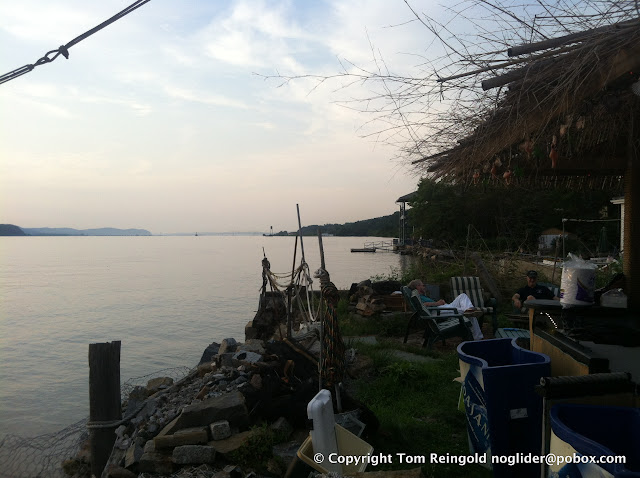
A view of the Hudson from the Yonkers Yacht Club.
We don't have a printer at the house, so I hand-copied the directions from the computer onto notebook paper. I clipped the directions to my handlebar bag. I also packed a lot of food plus a big external battery for my phone. I figured if I lost my way, I could use the phone to navigate, but I'd need extra charging capacity.
I left a little after 8am. I did get lost a few times, and I used the Google Maps app for a few periods, but I turned it off each time I got back on my course. At one point, I left the course deliberately because a bike trail was paralleling the road, and I used Google Maps to get me back on later. That worked out just fine.
I wore a little bicycle-specific GPS gadget on my wrist. It tracks where I go, how fast, etc. It was useful to count off the distances between turns.
With my several times of getting lost and one time of leaving the route on purpose, my total distance was 96 miles.
Much of the route was on bike trails, which are pretty nice to ride on. Sometimes the surface is rough, which slows me down a little, but the benefits are worth it. There is no motor vehicle traffic to cause stress, and it's much quieter. I have to watch for pedestrians and ride slowly around them, but that's a small price to pay. Most of the trails are old railroad lines with the tracks removed. Some are paved, and some are not.
The cable for my rear derailleur failed at about Mile 35. My front derailleur continued to work, leaving me with a choice of three different gears. I jury-rigged my rear derailleur to stay in a middle gear. In retrospect, I should have chosen a lower gear. The lowest of the three gears I had was still quite high. This made climbing hills very challenging. The biggest hill was Hosner Mountain Rd in Dutchess County, just south of Rt I-84. I challenged myself not to stop on any climbs until I reached the tops. Now that I look at my elevation profile, I can hardly believe I climbed that hill without a low gear.
My back and shoulders are weak and inflexible. I've been meaning to strengthen them for a long time. This makes riding for hours painful. Worse than that, I have a pinched nerve in my back which causes some pretty severe pain in my feet. Each hour gets worse. I think I don't want to take another very long ride until I can alleviate these problems. The second half of the ride was pretty painful.
But the weather was good, and the scenery was inspiring. I don't regret doing it at all.
Here is the log that my GPS unit created. You can zoom in and out on the map. You can also see graphs that show my speed over time and my elevation over time. You can see where I climbed about 250 feet in just about one mile, at Mile 41.
Here are pictures I took along the way. GPS information is embedded in them, so if you want to see the points where I shot the pictures, look at the page for this album.
Click on the images to see them bigger.
Rondout Creek
Rondout Creek
Walkill Valley Rail Trail
Walkill Valley Rail Trail
Walkill River (a redundant name)
Rt 299 going from New Paltz to Lloyd, one of the few non-gorgeo
Ah, that's better. Town of Lloyd.
About to enter Hudson Valley Rail Trail in Lloyd
Hudson Valley Rail Trail. Notice the glacial rock on the right side. It's 20 or 30 feet tall.
An old station reused somehow, but I didn't investigat
Highland Station, now closed, of course, since the rail line is gone.
About to cross the Walkway Over the Hudson, opened to pedestrian
Walkway Over the Hudson
Hudson River as viewed from Walkway Over the Hudson. That bridge you see is the Mid-Hudson Bridge. Both of these bridges span the Hudson between Highland and Poughkeepsie.
Hudson River as viewed from Walkway Over the Hudson.
Hudson River as viewed from Walkway Over the Hudson.
Hosner Mountain, whose switchback road doesn't switch back enough. The climb was very difficult, especially with a failed derailleur and resulting lack of low gears.
Hosner Mountain.
Hosner Mountain.
Now I can catch my breath a bit.
Crossing the West Branch Reservoir.
West Branch Reservoir.
Lake Gleneida in Carmel, NY.
An accidental selfie. Now you've seen my left knee.
Yorktown Heights, I think.
Hudson River, viewed from Yonkers.
Hudson River, viewed from Yonkers.
The Hudson River rail line, viewed from a pedestrian bridge. The rail line is a gorgeous ride, every inch of the way.
Sunset over the Palisades in New Jersey, across the Hudson.
Sunset over the Palisades in New Jersey, across the Hudson.
A view of the Hudson from the Yonkers Yacht Club.
Subscribe to:
Posts (Atom)